Hong Kong's Four Trails: A Beginner's Guide to a One-Day Hiking Adventure
Contents

Hong Kong's four major hiking trails have recently been thrust into the spotlight thanks to the popular documentary "Hong Kong's Four Trails." This film highlights the incredible feat of mountain runners who tackle a grueling 298-kilometer ultra-marathon in just 72 hours. They brave the MacLehose Trail, Wilson Trail, Hong Kong Island Trail, and the Phoenix Trail. While not everyone can achieve the "survivor" status of the film's protagonists, Kinnso has put together a one-day hiking itinerary featuring the most picturesque sections of these trails. This way, you can easily soak in the stunning beauty of Hong Kong's wilderness without the extreme challenge.
(Image sources: @shutterstock, Agriculture, Fisheries and Conservation Department "Country Parks" website, Official website of Hong Kong's Four Trails)
Hong Kong Four Trails Hiking|Essential Gear Checklist

- Sturdy hiking shoes or comfy sports shoes (with excellent grip and support)
- Sun protection essentials (a hat, sunglasses, and sunscreen)
- Ample drinking water (at least 1.5 liters is a must)
- Light snacks (think energy bars and dried fruits)
- A backup power source and your mobile phone
- Basic first aid kit
- Insect repellent spray
- Hiking poles (highly recommended)
Discover Hong Kong's Scenic Trails: A Journey on the MacLehose Trail
Segment Two: From Pak Tam Chung to Sai Wan
Difficulty: ★★★☆☆
Distance: 13 kilometers
Estimated Time: Around 4-5 hours
Highlights: Enjoy breathtaking mountain and sea views, with chances to marvel at stunning bays like Sai Wan, Long Ke, and Chek Keng along the route.
Route Details:
- Starting Point: Pak Tam Chung Bus Terminus
- Follow the clearly marked MacLehose Trail, passing by the serene Pak Tam Chung Reservoir
- Climb up to Lukhau Mountain for a sweeping view of the Sai Kung Peninsula
- Descend and pass by Sai Wan Pavilion, where you can soak in the distant view of Sai Wan
- Ending Point: Sai Wan Parking Lot
How to Get There and Back
Starting Your Journey:
- Hop on Bus 91 from Diamond Hill Station on the MTR and ride to Beitan Chuen
- Or, you can catch Minibus 1A from Choi Hung Station on the MTR to Beitan Chuen
Heading Back:
- For your return, take Bus 29R from the West Bay Car Park
- Alternatively, you can book a taxi to head back to the city
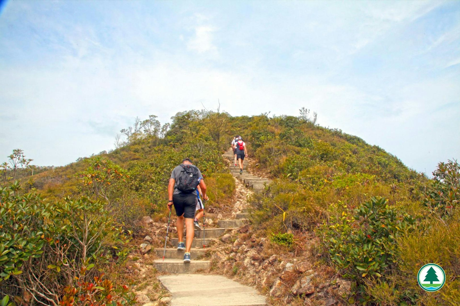
Hong Kong Four Trails Walk|Highlights of the Wilson Trail
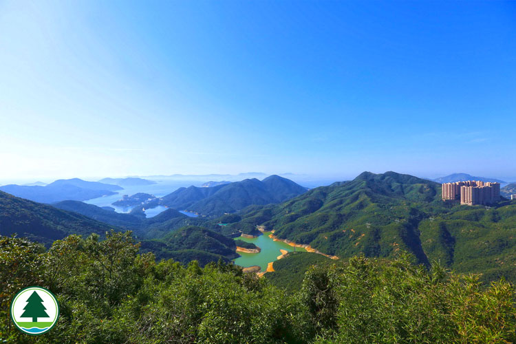
Section Four: From Tai Tam Reservoir to Chai Wan
Difficulty: ★★☆☆☆
Distance: 7.5 kilometers
Estimated Time: Approximately 3 hours
Highlights: A delightful mix of urban and natural scenes, featuring the picturesque Tai Tam Reservoir area and stunning views over Victoria Harbour.
Route Details:
- Starting Point: Tai Tam Reservoir Road
- Head along the Upper and Middle Tai Tam Reservoirs
- Pass by Violet Hill, where you'll be treated to sweeping views of the Southern District of Hong Kong Island
- Make your way down towards Chai Wan
- Ending Point: Chai Wan MTR Station
Getting There
Starting Point:
- Hop on Bus No. 14 at Hong Kong MTR Station and ride to Tai Tam Reservoir Road
- Alternatively, you can catch Bus No. 6 from Causeway Bay MTR Station heading to Tai Tam Road
Destination:
- For your return, simply take the MTR from Chai Wan Station back to the city
Exploring the Hong Kong Island Trail | Must-See Spots on the First Section
From Victoria Peak to Pok Fu Lam Reservoir
Difficulty: ★★☆☆☆
Distance: 8 kilometers
Estimated Time: About 3-4 hours
Highlights: Take in the stunning views of Victoria Harbour and visit popular spots like the Lugard Road Lookout and The Peak Galleria along your journey.
Route Details:
- Starting Point: The Peak Galleria
- Stroll along the scenic Lugard Road walkway
- Make your way through Pokfulam Street and Hatton Road
- Follow the trail up to Pok Fu Lam Reservoir
- Ending Point: Pok Fu Lam Reservoir
Getting There
Starting Point:
- Hop on the Peak Tram from Central to the Peak Galleria
- Or, you can catch Bus No. 15 to the Peak
Heading Back:
- From Pok Fu Lam Reservoir, take Bus No. 4 back to Central
- Alternatively, you can take Bus No. 30X to Central
Discover Victoria Peak in Hong Kong - Choose Between the Sixth Generation Peak Tram Ticket or Sky Terrace 428 Admission Ticket
Discovering the Phoenix Trail: A Hong Kong Adventure
Sections One and Two: Journey from Tai O to Mui Wo
Difficulty: ★★★☆☆
Distance: 10 kilometers
Estimated Time: About 4 hours
Features: Immerse yourself in the distinctive landscape of Lantau Island, with panoramic views of the Hong Kong-Zhuhai-Macao Bridge and breathtaking scenery along the way.
Route Overview:
- Starting Point: Tai O Bus Terminus
- Climb up the stone path, passing by the iconic Rat Mountain
- Stroll through the quaint village of Dog Ridge Stream
- Descend along the scenic mountain road to Mui Wo
- Ending Point: Mui Wo Ferry Pier
How to Get There:
Starting Your Journey:
- Hop on bus number 11 from Tung Chung MTR Station straight to Tai O
- Alternatively, catch a boat from Central Pier heading to Tai O
Wrapping Up Your Trip:
- Take a scenic boat ride back to Central from Mui Wo Pier
- Or board bus number 3M to return to Tung Chung Station
Explore Lantau Island | Discover the Tian Tan Buddha and Spot Dolphins
Related Articles
Recommended Pet-Friendly Malls: Explore Pet-Friendly Malls Across Hong Kong Island, Kowloon, and the New Territories! Includes Facilities and Guidelines